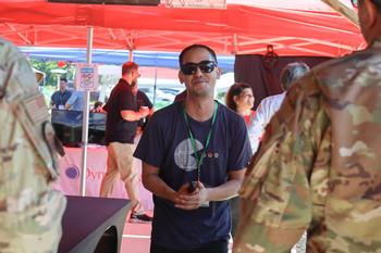
Fairfax, Va. (May 21 – May 22, 2024): The two-day premiere Thunder Drone Exhibition welcomed individuals from the National Security and Defense communities to Xelevate facilities in Leesburg, VA, to showcase emerging drone technologies, led by George Mason University faculty research. Faculty teams presented several areas of research including UAV detection, drone swarms, and 3D mapping through an industry Unmanned Aircraft Systems (UAS) sandbox. Below are the four research areas showcased during the event.

Rajesh Ganesan, Kuo-Chu "KC" Chang,
Michael Hieb, Lieutenant Colonel Charles
"Chaz" LeDeatte, Sherry Crissman,
Alexander Brodsky.
Mason’s UAV Systems and Cyber Analysis Testbed (MUSCAT)
The Muscat Team led by Ali Raz, (Assistant Professor, Department of Systems Engineering and Operations Research), at George Mason University (GMU) is developing an Unmanned Aerial Vehicle (UAV) detections, tracking, and sensor placement analysis capability called Mason’s UAV Systems and Cyber Analysis Testbed (MUSCAT). MUSCAT combines systems engineering principles with state-of the-art in sensor data fusion and mathematical optimization to enable Counter UAV (C-UAV) evaluations in a given geographical region.
MUSCAT is designed to be user configurable for new sensors, UAVs types and custom geographical regions. Recent results are focused on analyzing sensor coverage for C-UAV with terrain models to identify the optimal placement of multiple sensor types, to include RADAR and Optical sensors, and provide a costperformance trade-off with sensor type, quality, and range.
Multi-Modal Adaptive Basing Logistics Planning System (M2ALPS)
The Air Force has adopted an Adaptive-Basing (AB) concept of operations. AB requires rapid and flexible logistics operations to ensure equipment, supplies, and personnel are transported in a timely and cost-effective manner. Existing processes rely on manual logistics planning methods that cannot easily trade-off between efficiency, effectiveness, and robustness. The Multi-Modal Adaptive Basing Logistics Planning System (M2ALPS) team led by Lance Sherry and Shima Mohebbi (Systems Engineering and Operations Research, Faculty), provides the Logistics Planning Specialist and the Logistics Planning Analyst a digital sandbox to plan and better understand possible interactions and trade-offs. The M2ALPS tool is a prototype for concept demonstration purposes.
Department of Electrical and Computer Engineering
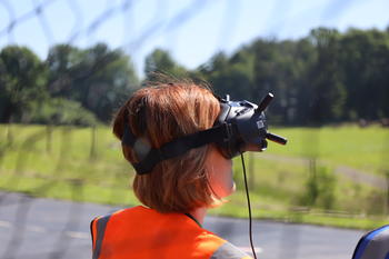
Deploying Effective Multi-Robot Systems and Swarms
The Drone team, led by Cameron Nowzari (Department of Electrical and Computer Engineering, Faculty) combines engineered decision-making, precision, and planning algorithms for heterogeneous multirobot systems with edge-based information gathering and kinetic options for self-organizing swarms of robots. Gregory Stein (Department of Computer Science, Faculty) focuses on top-down long-duration planning and team resource allocation with uncertainties while Daigo Shishika (Department of Mechanical Engineering, Faculty) designs precise controllers that make decisions on how the robots should move for successful engagements. Xuesu Xiao (Department of Computer Science, Faculty) and Nowzari focus on the bottom-up edge capabilities of the robots with Xiao enhancing the individual robot capabilities and Nowzari taking advantage of synergies and emergent behaviors of the swarm of robots working together. This enables a holistic employment approach for a heterogeneous team of robots to effectively work together while leveraging the unique capabilities of different assets.

Department of Computer Science
3D Mapping
Focusing on evaluating and demonstrating the capabilities of drone-based 3D mapping technologies, the 3D mapping team led by Zoran Duric (Department of Computer Science, Faculty), compares LiDAR and photogrammetry across various environments. Through extensive testing, LiDAR provides unmatched precision, photogrammetry offers a compelling balance of quality and affordability. This research extends into practical applications such as visual localization, where a camera on a vehicle captures images of the environment and localizes them relative to a 3D map, serving as an alternative to GPS. The team is working on endowing 3-D point cloud maps with semantic labels (such as cars, buildings, trees) that will support various downstream tasks such as change detection, mission and sensor placement planning, and decision making. The project team included Jana Kosecka (Department of Computer Science, Faculty) and Kevin Murray (PhD candidate).
This signature event was a major milestone in the Education Partnership between George Mason and AFCENT with research led by Amarda Shehu (College of Engineering and Computing) and Brett Josephson (Costello College of Business) as the Principal Investigators. Given the success of the event, more collaboration to follow in Fall 2024. Learn more about the Educational Partnership Agreement.
Computer Science; Associate Dean for AI
Innovation in the CEC, Associate VP of
Research (IDIA)